
Map of Blaxland's route across the Blue Mountains in 1813.
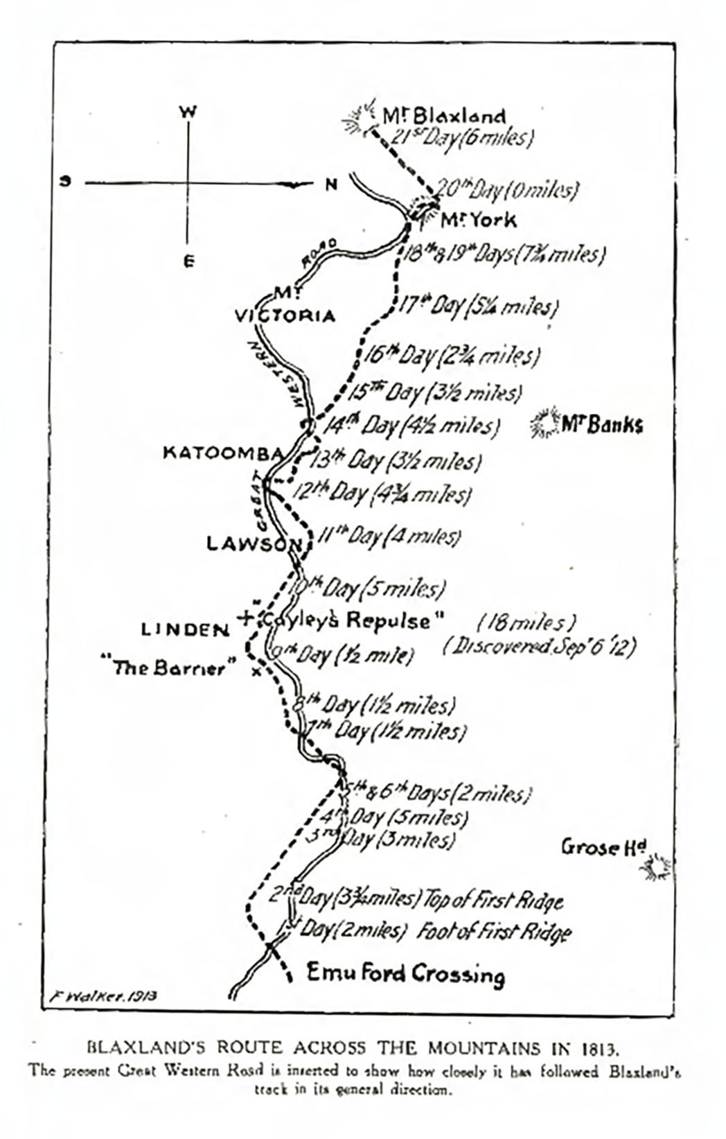
A sketch map of Blaxland, Lawson and Wentworth’s route across the Blue Mountains in 1813 prepared by F Walker in 1913. The Great Western Road has been included to show how closely it follows the route taken by the explorers.
Source
Frank Walker, Journal of Gregory Blaxland

Details
+ --
Themes: