
A map showing sheep and wheat growing areas of Australia, published in the 1920s.
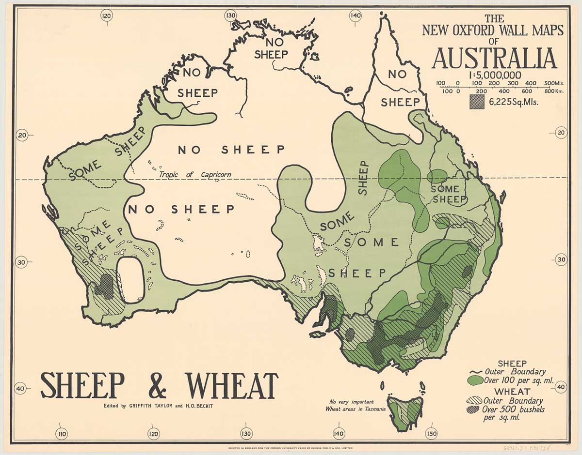
The new Oxford wall maps of Australia. Sheep & wheat. Edited by Griffith Taylor and H.O. Beckit.
Source
National Library of Australia, obj-234331946

Details
+ --
Themes:
-
Type: