
Learning module:
Water in Australia Defining Moments
Investigation 1: Water in Australia
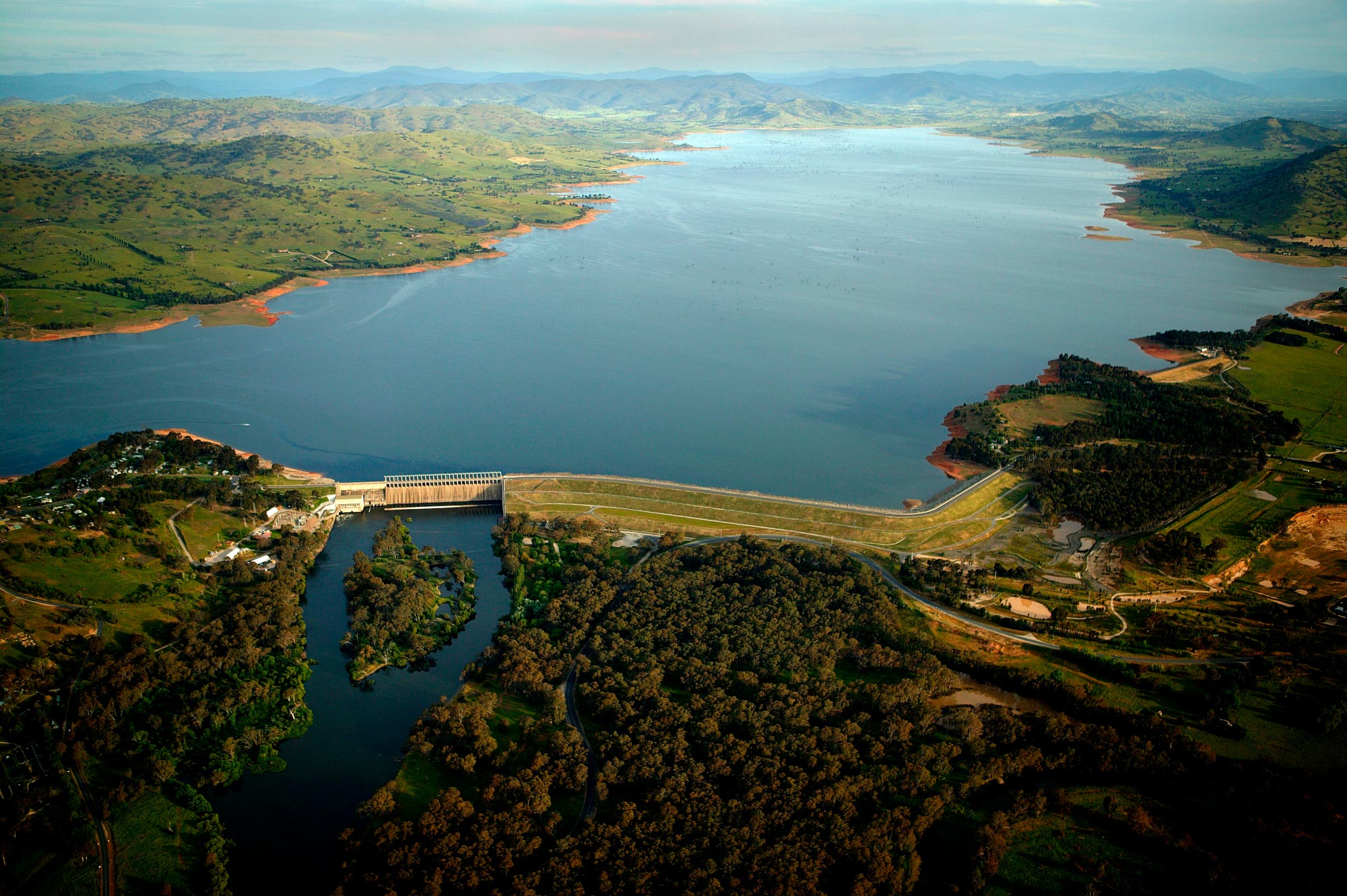

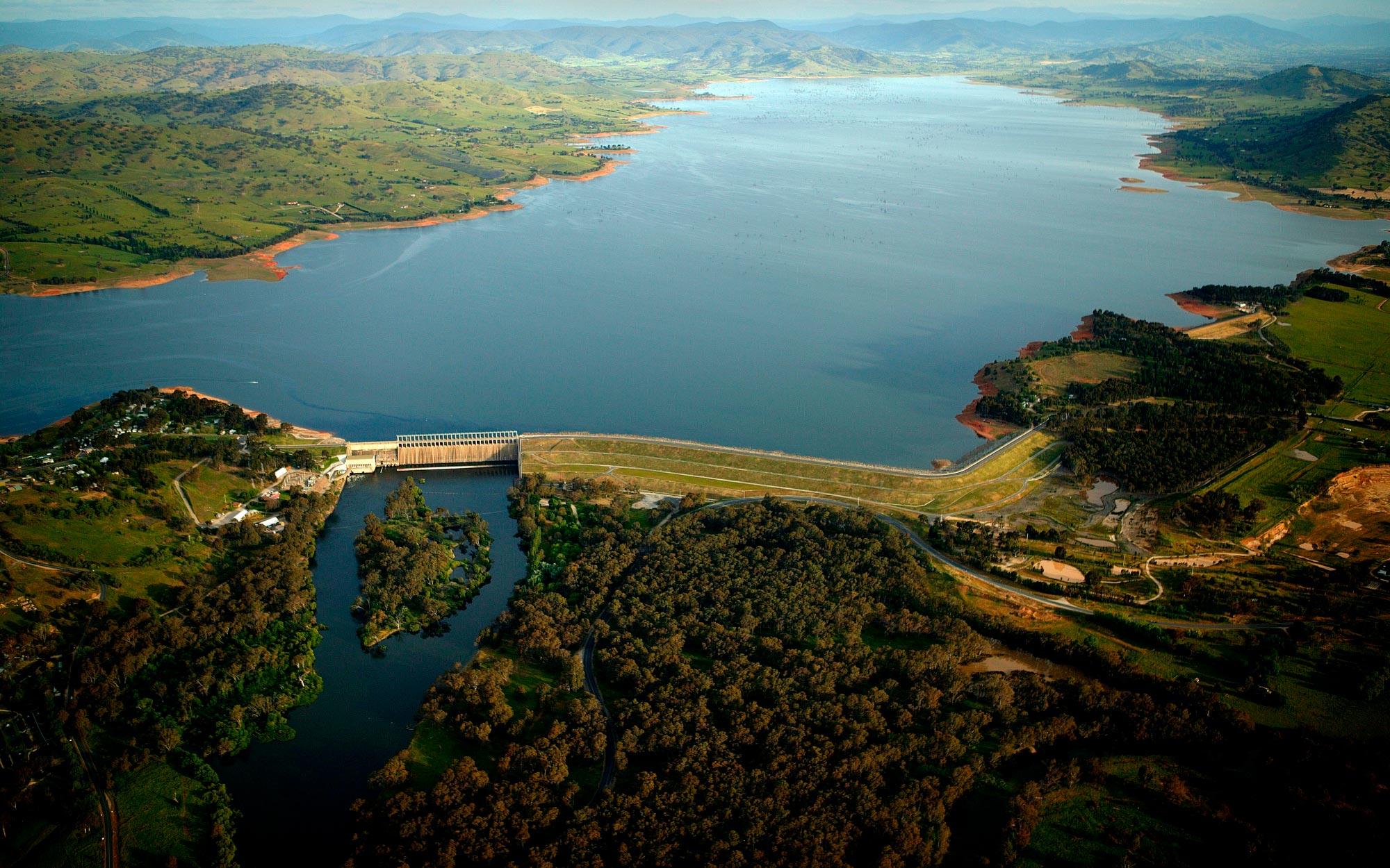
1.4 Water into power — Snowy Mountains Hydro-Electric Scheme
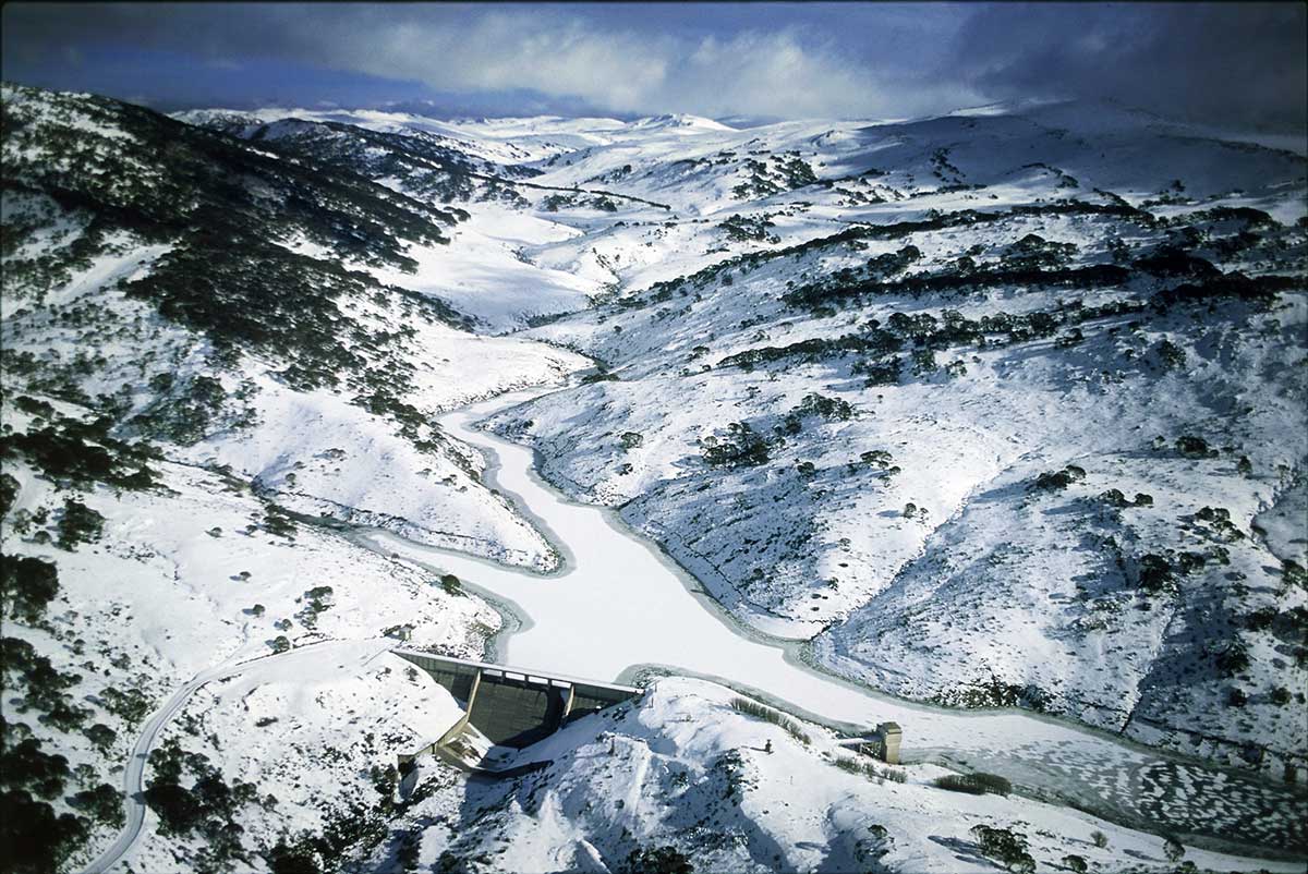
Photo: Ross Dunstan, Australian Geographic
Investigation 1.2 explored how people began using river water for irrigation. Investigation 1.3 explored how people dammed river water to control the flow.
Attention next focussed on how to increase the amount of water actually flowing down the rivers.
In this investigation you will explore:
- What was the Snowy Mountains Hydro-Electric Scheme?
- What impacts did it have on people?
- What impacts did it have on the places and environments involved?
Imagine that it is 1720 in Australia. You are in the area of the Australian Alps, home of the Ngarigo people for at least 20,000 years.
Rain and snow fall on these Alps seasonally. Most of the rainwater and snowmelt flows down the eastern side of the Alps in the Snowy River, ending up in Bass Strait, part of the Tasman Sea.

Eliane Touma
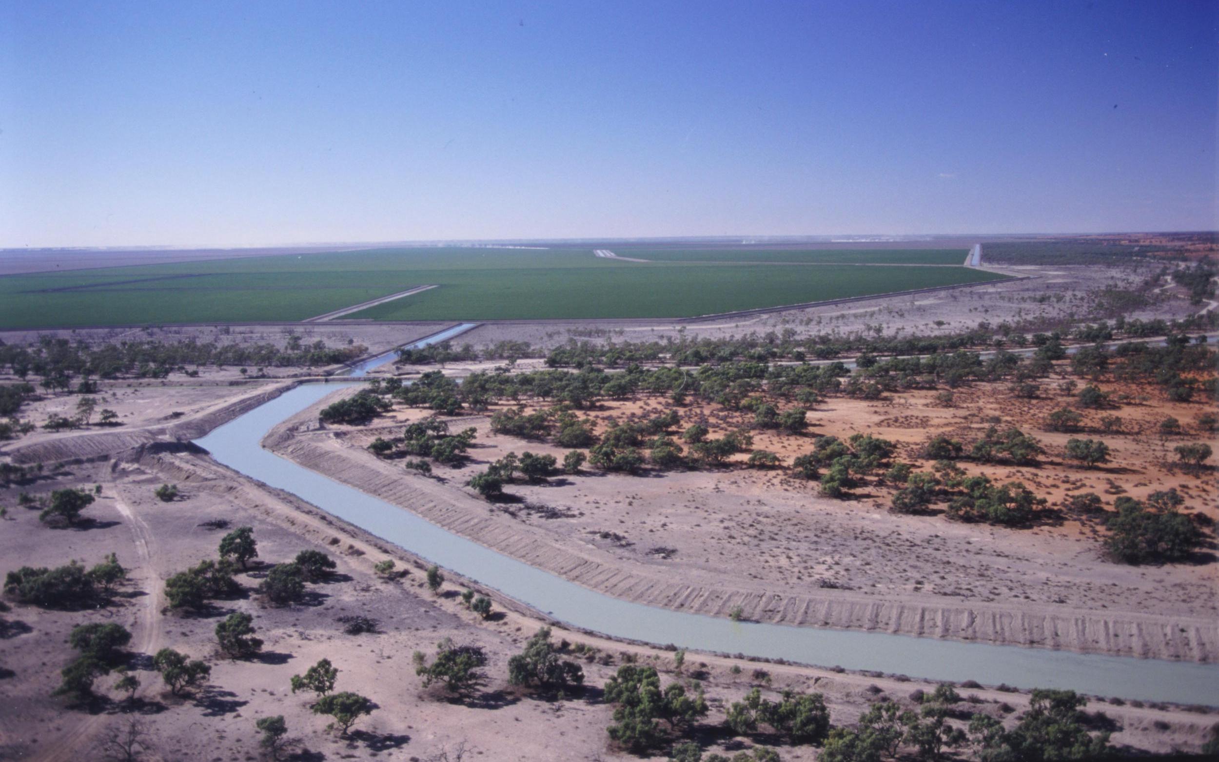
Some of the water flows to the west, into two large rivers — the Murrumbidgee and the Murray. These eventually also flow to the sea, but further away — at Encounter Bay in South Australia.
These rivers are seasonal in their flows. They sometimes flood, inundating the floodplains, and are sometimes in drought, becoming a chain of ponds rather than a flowing river.
1. How do you think
- animals
- vegetation
- people
would be able to survive in these variable conditions?
300 years later, the situation has changed considerably:
- The water and snowmelt on the Alps have been diverted from flowing east, to flowing west.
- There are now many dams that regulate or control the amount and timing of the water flows into the two great rivers.
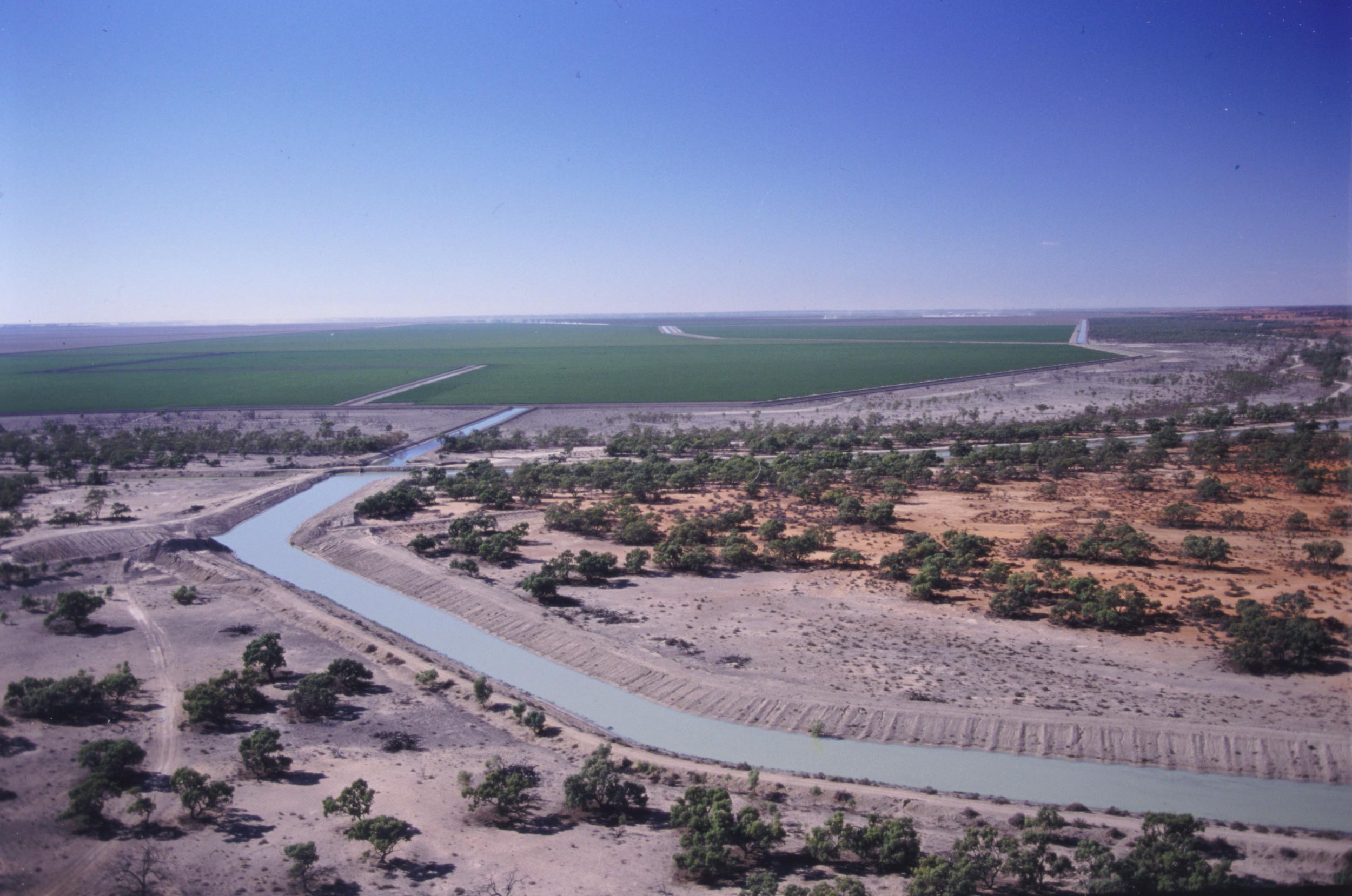
- There are many farms along the rivers, with water being taken from the rivers through a process of irrigation.
The climate is still variable, with some periods of heavy rain, and other periods of drought.
Snowy Hydro Limited
2. How do you think the following might have changed in 300 years?
- The flow of the Snowy, Murray and Murrumbidgee Rivers
- The floodplains of the Murrumbidgee and Murray Rivers
- The salinity of Lake Alexandrina
- The vegetation of the riverine area
- The way people use water in this area
- The amount of water available to people downriver of the junction of the Murrumbidgee and Murray Rivers?
Make some notes about these issues here:
3. What do your predictions suggest about the:
- economic
- social
- environmental
impacts of the way water is used in the Snowy region today?
In 1949 the Australian Government decided to create the Snowy Mountains Hydro-Electric Scheme, which was completed in 1972.
How did this scheme affect the south-east of Australia? What were its impacts on people and environments? What were its benefits and costs? Could such a scheme be built today?
Read the Defining Moment in Australian history: 1949 ‘A plan for the whole nation’ — Snowy Mountains Hydro and answer the following questions.
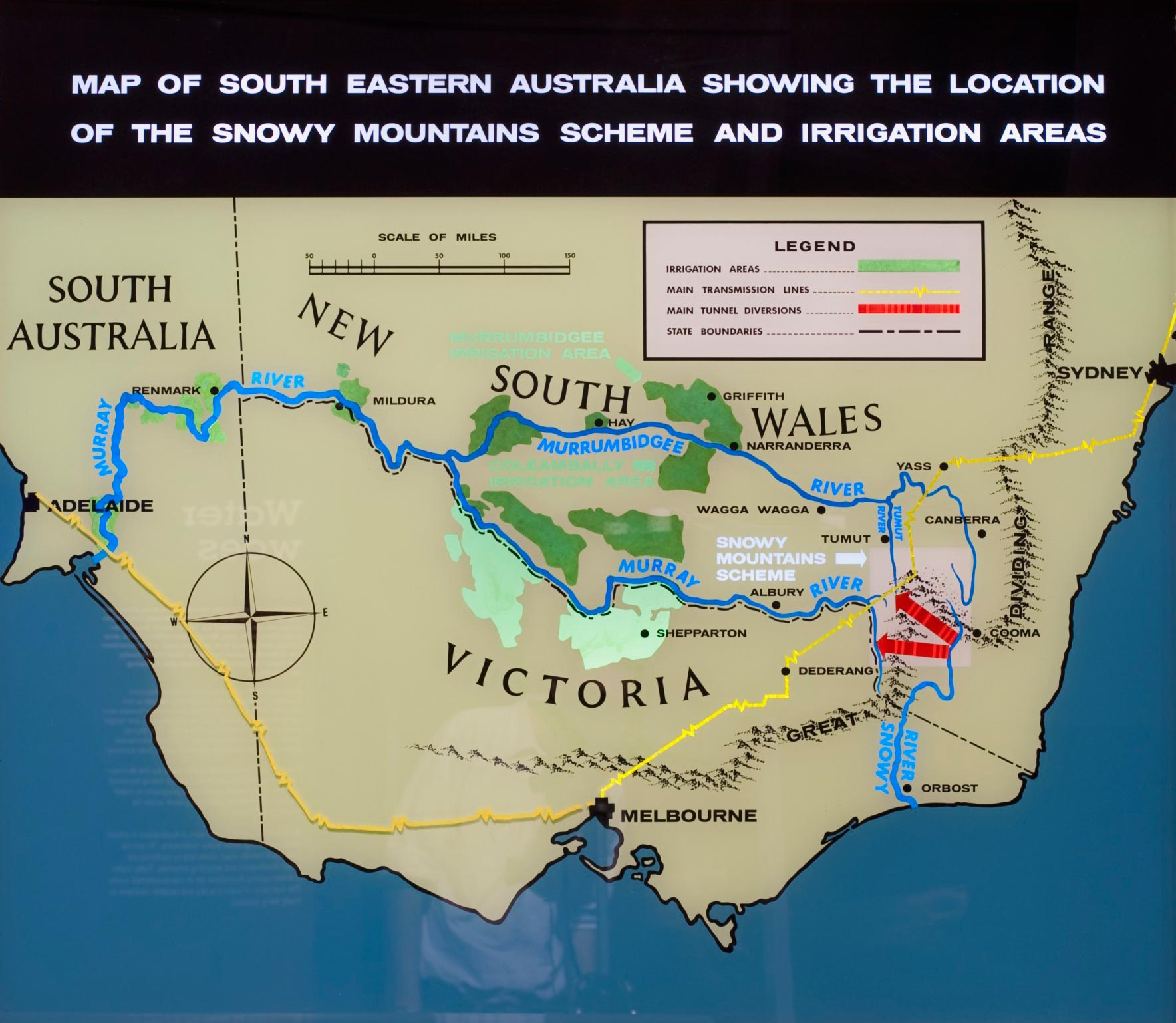
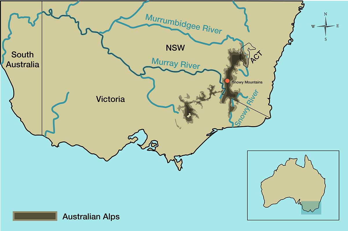
The Snowy Mountains are located in the south-east of Australia, in Kosciuszko National Park. Look at this map:
Eliane Touma
4. In which state or territory are the Snowy Mountains found?
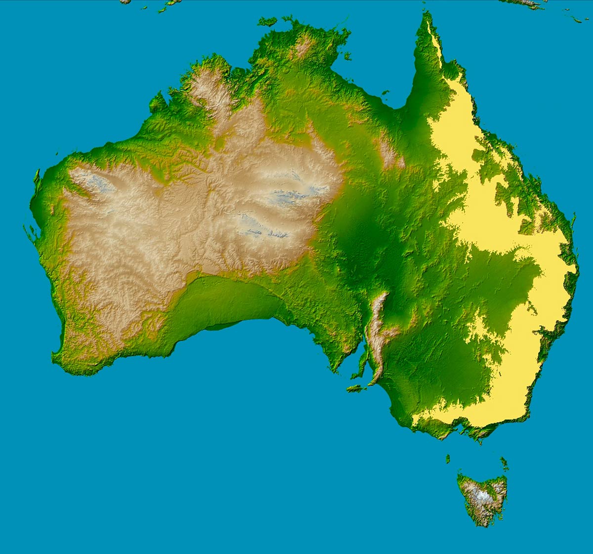
They are part of the mountain range called the Great Dividing Range, shown in this map in yellow:
Ordinary Person / Wikimedia Commons

Fir0002/Flagstaffotos, CC BY-NC 3.0
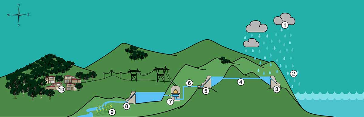
Look at the diagram below. It is a cross-section of part of the Snowy Mountains Hydro-Electric Scheme. (A cross-section is where you take something, such as an orange, and cut it in half and look at the insides).
The people who made the Snowy Hydro-Electric Scheme had to move the rainwater and snowmelt from the east side of the mountains (the right side as you look at it) to the west side of the mountains (the left side as you look at it). The water could not be moved across the mountains, so it had to be pumped from one side to the other in tunnels dug through the mountain.
Eliane Touma
9. Drag the correct description to match each number from the diagram. When you have placed the 10 sentences into the correct order they will give you a clear description of how the water is moved.
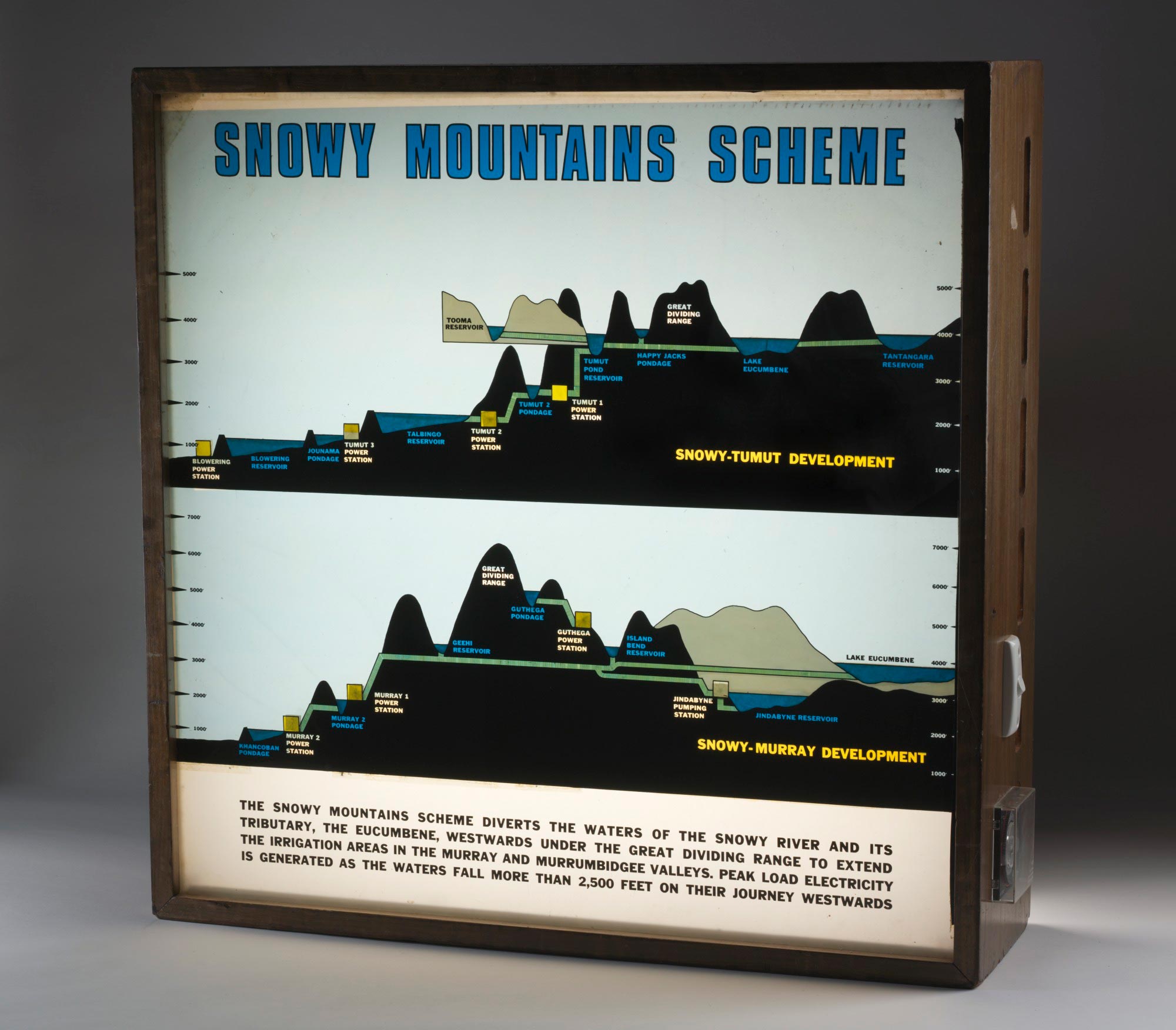
Here is a different diagram of the system. It had two parts: sending water to the Murray River, and sending water to the Murrumbidgee River, which then flowed into the Murray River.
Snowy Hydro Limited
Look at this overview map again:
Snowy Hydro Limited
Watch some 1959 newsreel footage of one of the Snowy Hydro dams to get a sense of the scale and importance of the Snowy Hydro-Electric Scheme.
18. It is time to consider some of the impacts of the Snowy Mountains Hydro-Electric Scheme. Read each impact summary and choose which themes it fits best with.
19. What do you now think were the main benefits and costs of this scheme to bring water and electricity west of the Snowy Mountains to Australian communities?
Conclusion
20. Do you think a similar scheme — for example, bringing the excess flood water from the north of Australia to the south — would be possible economically, socially and environmentally? You might research this further.
21. In 2018 the Liberal–National Party Coalition Government announced a plan to build ‘Snowy 2.0’. Do some research to find out more about the project. Does your research lead you to think it is a good idea or do you have concerns about it?
Finding out more
Watch this animation about the Snowy Mountains Hydro-Electric Scheme which summarises the story of ‘the Snowy’.