
Water in Australia Defining Moments
- Year level 7
- Investigations 1
- Activities 7
- Curriculum topic Water in Australia
1. Overview of the learning module
Introduction
This learning module provides resources and classroom activities for teachers to use in their Australian Curriculum — Geography Year 7 classrooms.
It supports the Geography knowledge and understanding requirements in relation to Australia for the Geography element of the curriculum:
- Water in the world.
It does so by exploring five case studies that illustrate key elements of this theme.
The investigations provide a rich digital resource for classroom use. They include contextual information, documents, images, scaffolded comprehension, analytical and extension questions, and individual, group and class activities. Using these materials and activities, students can explore aspects of the Year 7 knowledge and skills outcomes specified in the Australian Curriculum — Geography.
The learning module has been designed to draw on the National Museum of Australia’s Defining Moments in Australian History, together with some supplementary resources. Students do not need to visit that site to complete this learning module as the featured Defining Moments used are available on this site.
Module snapshot
This learning module contains:
These activities examine attitudes toward water and how water has been used in Australia.
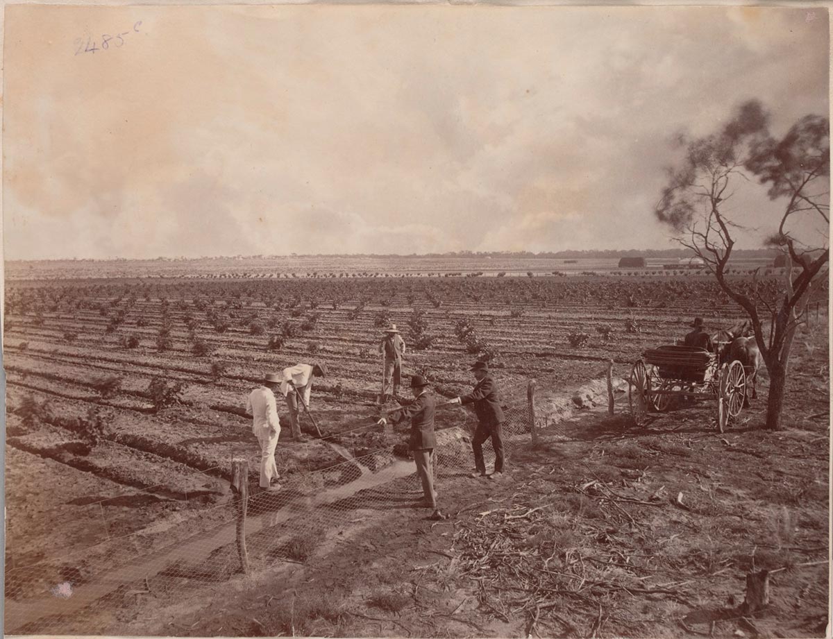
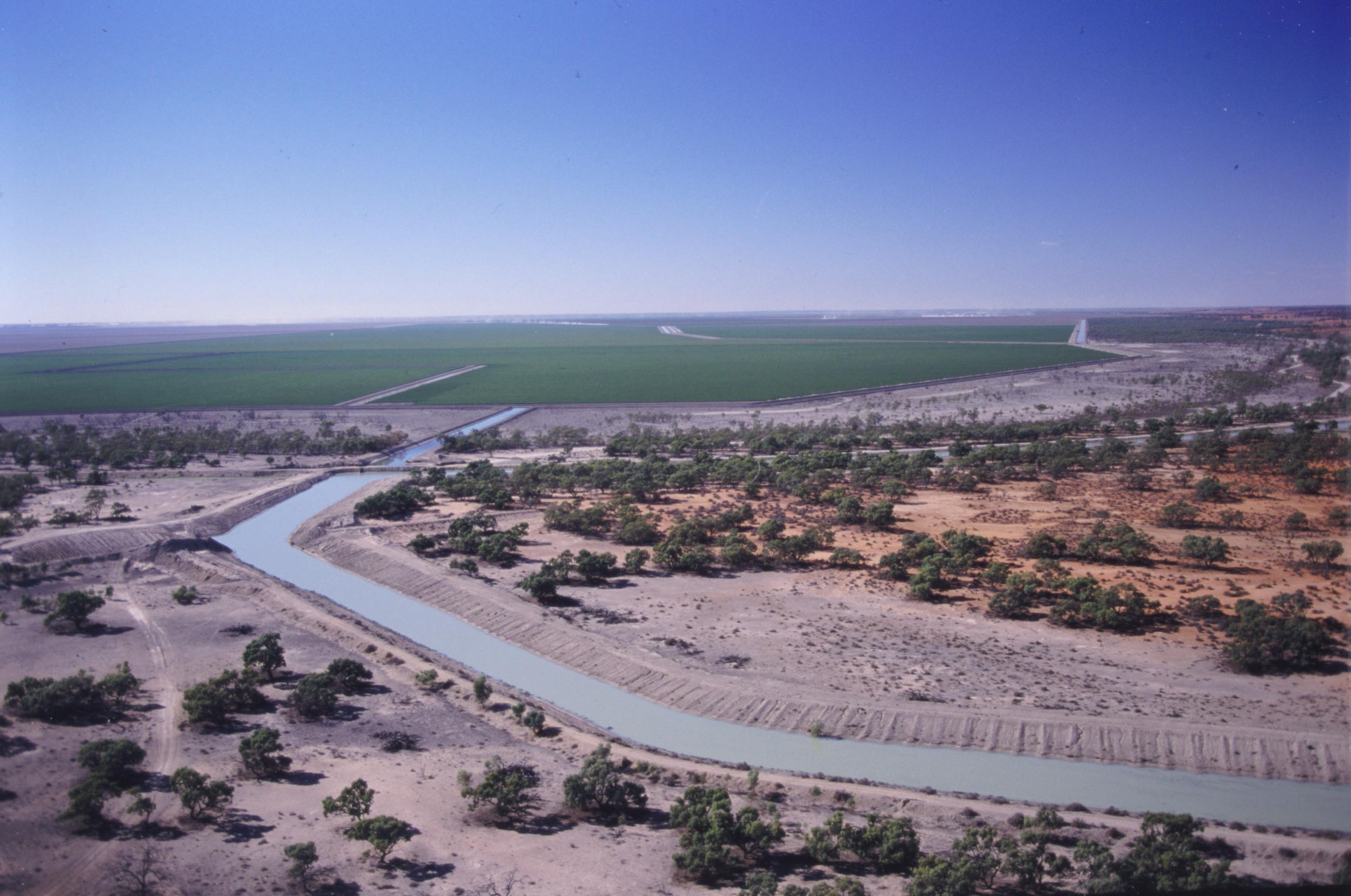
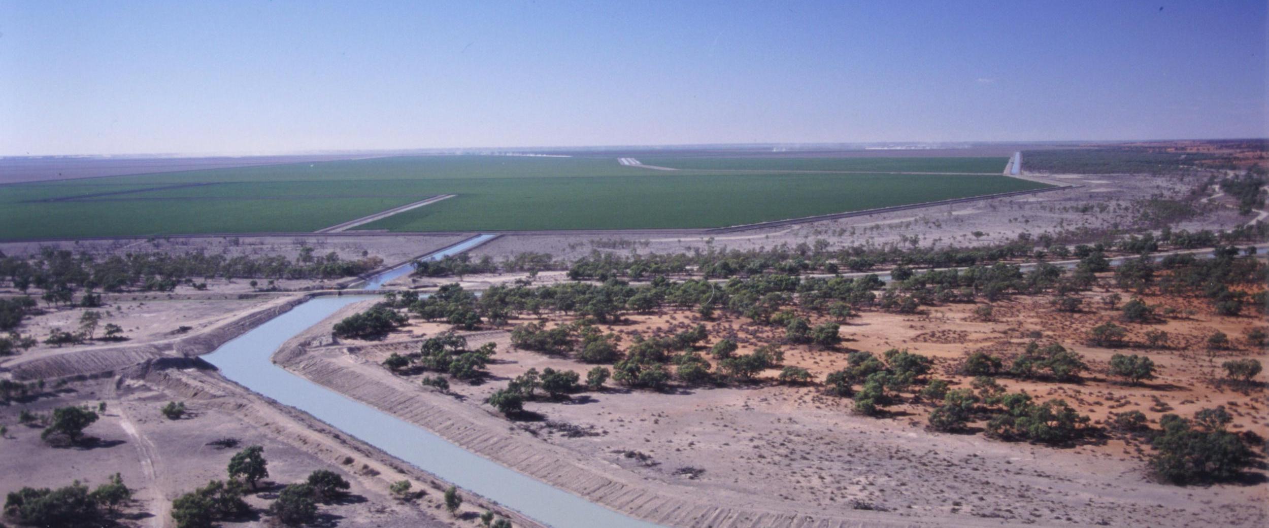
In Investigation 1.2 students look at the first major irrigation colony created in Australia, at Mildura and Renmark, on the Murray River. At this time, water was mainly considered as a practical resource that could be used for economic, agricultural and social developments.
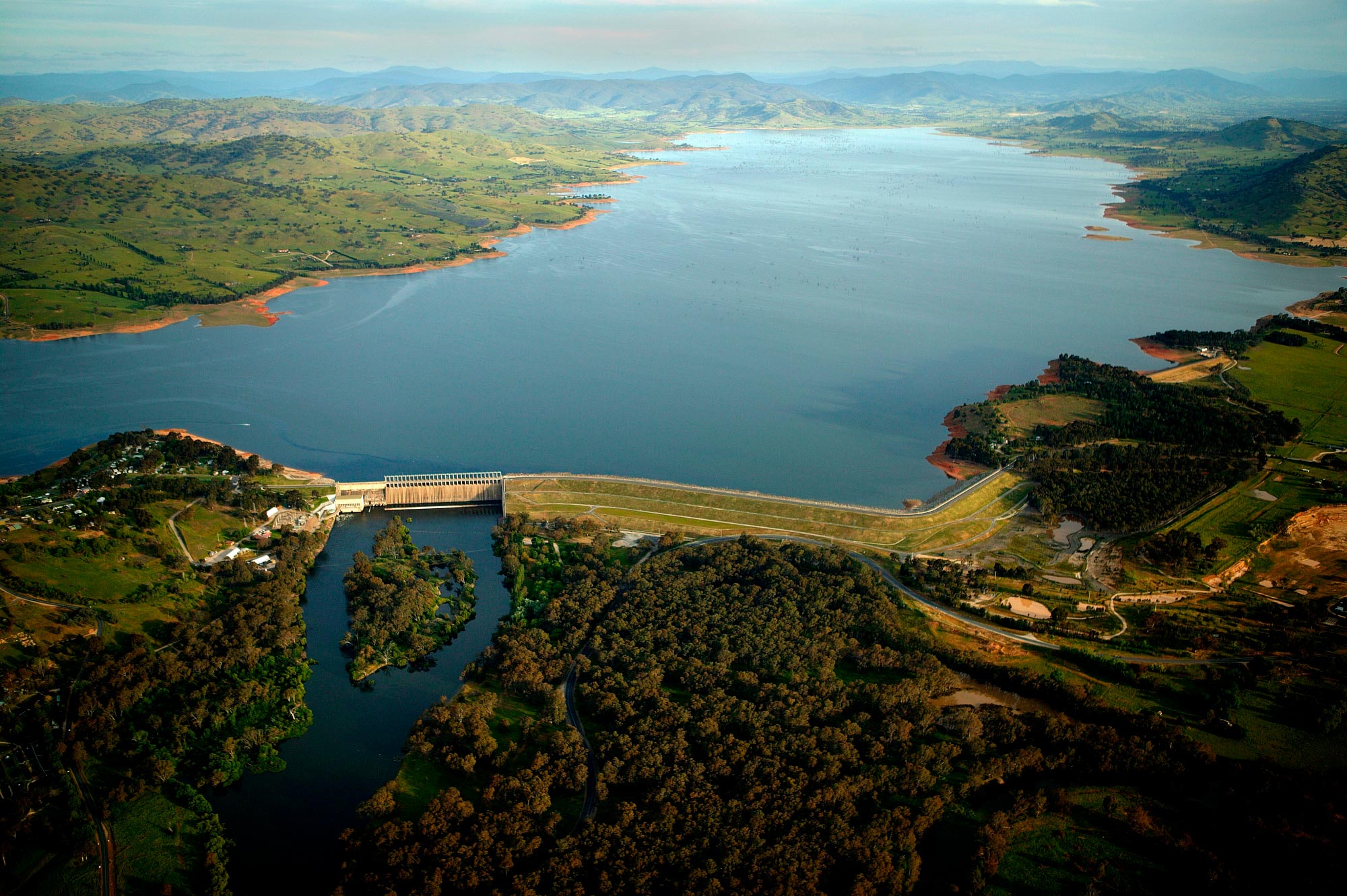
Next students learn about the construction of the Hume Dam (Investigation 1.3), designed to control the volume and timing of natural flows along the Murray River for economic benefits.
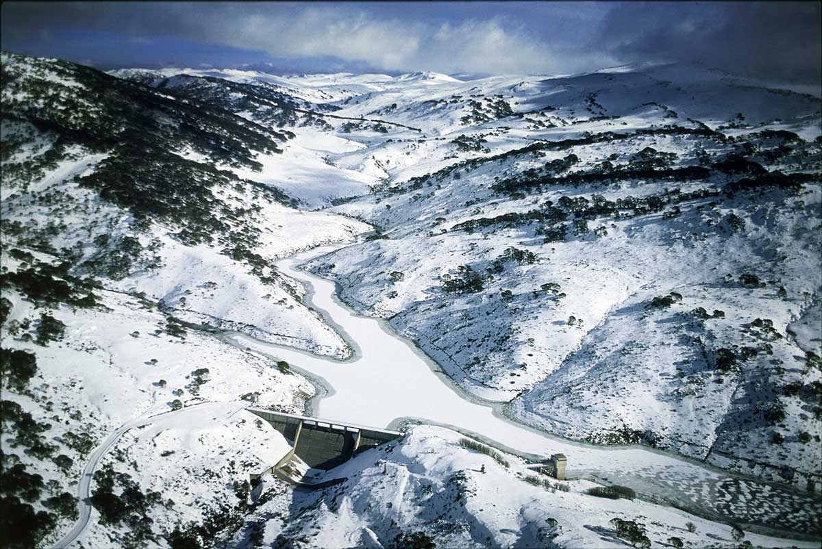
The Snowy Mountains Hydro-Electric Scheme (Investigation 1.4) involved the massive task of altering natural flows from one side of the mountain range to the other. Students learn about how the Scheme works and consider some of the implications for people and the environment.
Investigation 1.5 allows students to start investigating competing interests over water use in the Murray–Darling Basin. They identify how agricultural, environmental, Indigenous and township attitudes and values towards water can make it difficult to govern an area effectively.
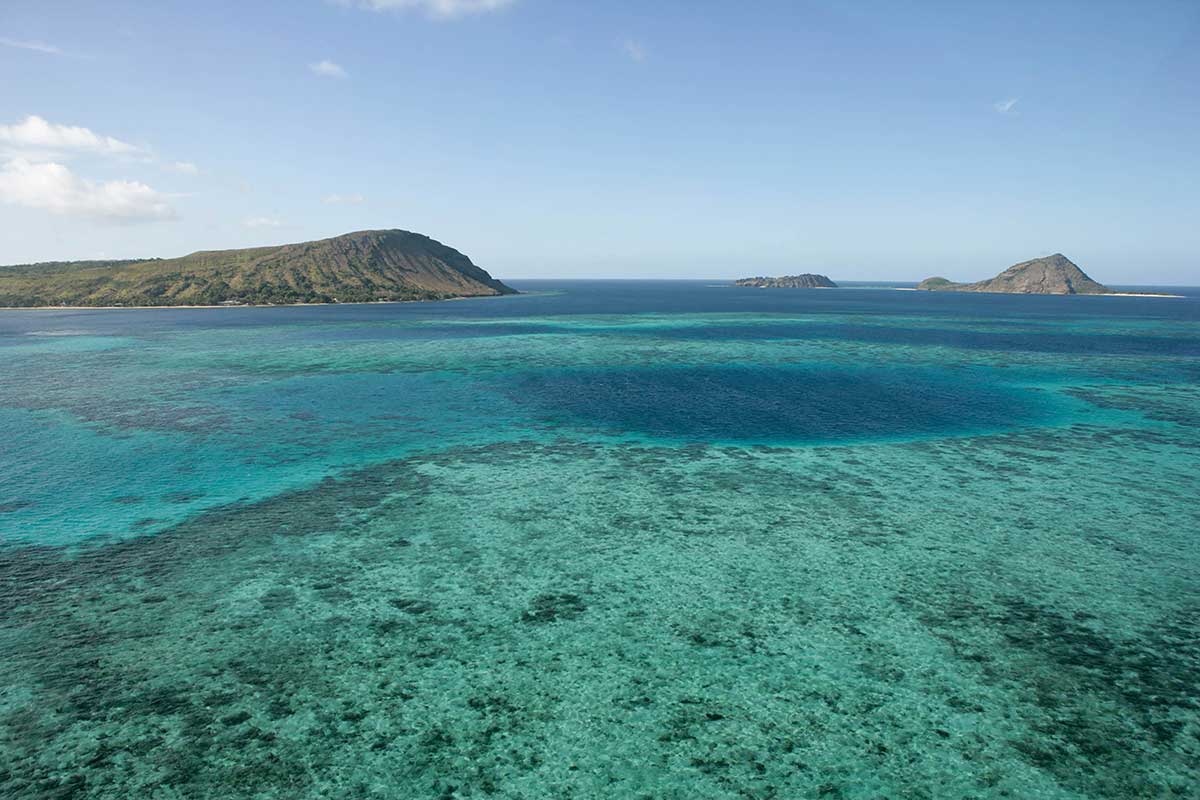
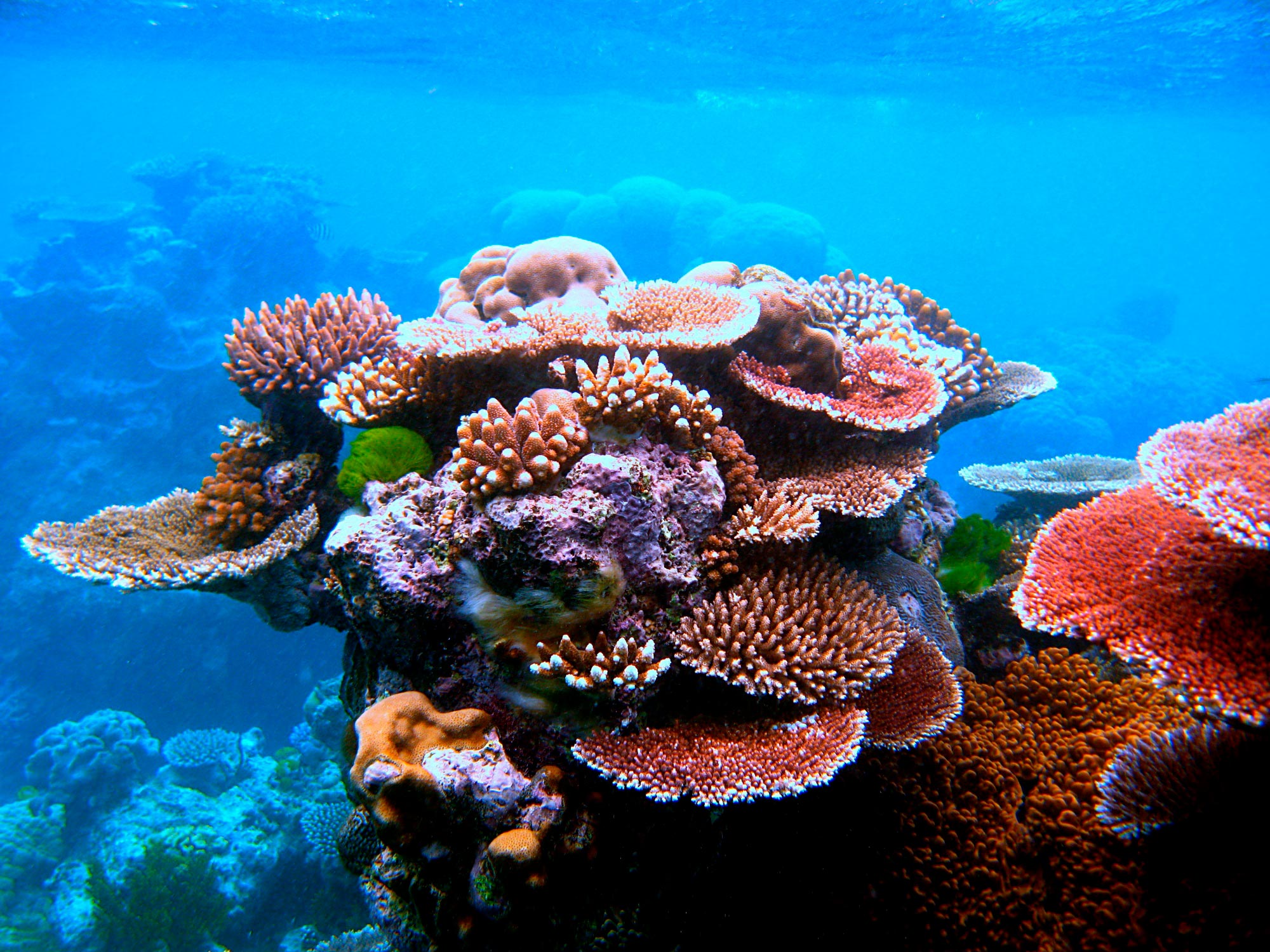
Finally in Investigation 1.6 students study the differing attitudes and values people hold toward using the Great Barrier Reef as an economic resource. They see how legislation can determine the way the area of water is managed.
Students complete their investigation by reflecting on the uneven distribution of water and sustainability in Australia.
2. Student activities
Student activities
Investigation 1: Water in Australia
Bringing it together
3. Relevant Defining Moments in Australian history
Defining Moments that are relevant to the different inquiry questions in the curriculum include:
|
1887 |
Investigation 1 |
|
|
1936 |
‘The greatest irrigation work in the Southern Hemisphere’ — Opening of the Hume Dam |
Investigation 1 |
|
1949 |
Investigation 1 |
|
|
1975 |
‘An irreplaceable part of Australia’s natural heritage’ — Great Barrier Reef Marine Park created |
Investigation 1 |
|
2012 |
‘We need radical and permanent change’ — Murray–Darling Basin Plan introduced |
Investigation 1 |
Longer versions of the Defining Moments are available on the National Museum of Australia website.
|
1887 |
Investigation 1 |
|
|
1936 |
Investigation 1 |
|
|
1949 |
Chifley government begins Snowy Mountains Hydro-Electric Scheme |
Investigation 1 |
|
1975 |
Investigation 1 |
|
|
2012 |
Investigation 1 |
4. Australian curriculum level and focus
Geographical knowledge and understanding
By the end of this learning module, students will have increased their knowledge and understanding in relation to Australia of aspects of Unit 1 Water in the world:
- The way that flows of water connects places as it moves through the environment and the way this affects places (ACHGK038)
- The nature of water scarcity and ways of overcoming it (ACHGK040)
Geographical skills
Students will have exercised these learning skills:
Collecting, recording, evaluating and representing
- Evaluate sources for their reliability and usefulness and select, collect and record relevant geographical data and information, using ethical protocols, from appropriate primary and secondary sources (ACHGS048)
Interpreting, analyzing and concluding
- Interpret geographical data and other information using qualitative and quantitative methods, and digital and spatial technologies as appropriate, to identify and propose explanations for spatial distributions, patterns and trends, and infer relationships (ACHGS051)
- Apply geographical concepts to draw conclusions based on the analysis of the data and information collected (ACHGS052)
Communicating
- Present findings, arguments and ideas in a range of communication forms selected to suit a particular audience and purpose; using geographical terminology and digital technologies as appropriate (ACHGS053)
Interdisciplinary thinking
Students will have engaged with the concepts of:
- significance
- continuity and change
- cause and effect
- place and space
- interconnections
- roles, rights and responsibilities
- perspectives and action.
Cross-curriculum priorities
Students will have been involved in additional learning about aspects of:
- Aboriginal and Torres Strait Islander societies
- sustainability.
Source: The Australian Curriculum Humanities and Social Sciences – Geography, December 2016, accessed 1 May 2019
5. Geography outcomes matrix
|
Outcome |
Elaboration or explanation |
Applying this to each case study |
|---|---|---|
|
KNOWLEDGE |
Comprehending the factual elements of systems or features. |
Do you know what the key facts are? |
|
UNDERSTANDING |
Being able to explain how features and systems operate. |
Do you understand how the key features and systems work in the way they do? |
|
PLACE |
The significance of places and what they are like. |
What are the key natural, environmental and human features of the place? |
|
SPACE |
The significance of location and spatial distribution, and ways people organise and manage the spaces that we live in. |
What creates the features, and how are they used? |
|
ENVIRONMENT |
The significance of the environment in human life, and the important interrelationships between humans and the environment. |
What are the key features, how are they used and managed, and with what effects? |
|
INTERCONNECTION |
Emphasising that no object of geographical study can be viewed in isolation. |
How is a place, space or environment connected to others? |
|
SUSTAINABILITY |
The capacity of the environment to continue to support our lives and the lives of other living creatures into the future. |
How is the place, space or environment being used and managed, and can this be continued? |
|
SCALE |
The way that geographical phenomena and problems can be examined at different spatial levels. |
Is the scale personal, local, regional, national or global? |
|
CHANGE |
Explaining geographical phenomena by investigating how they have developed over time. |
How is it similar or different over a time period? |
6. Learning at the National Museum of Australia
Enjoying our online teaching resources? Why not check out what else we have to offer?
We run onsite school programs, digital excursions and teacher professional learning programs.